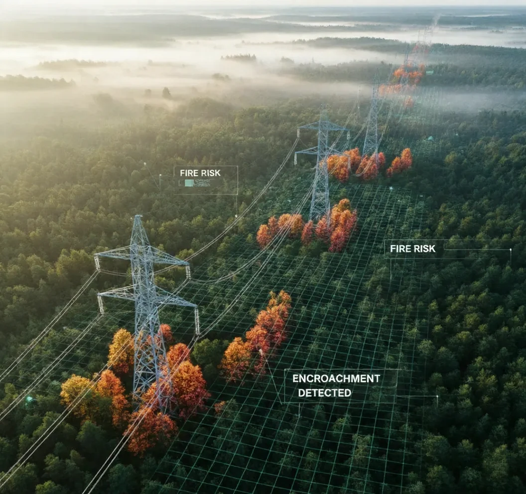
Overgrown roadside vegetation near mines, roads, or power lines poses a serious fire and safety hazard, yet traditional patrols may miss fast-growing threats.
VegAlert Pro
Prevent Wildfires Before They Start

Overview
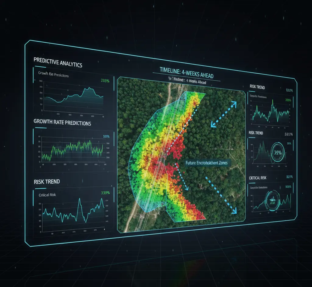
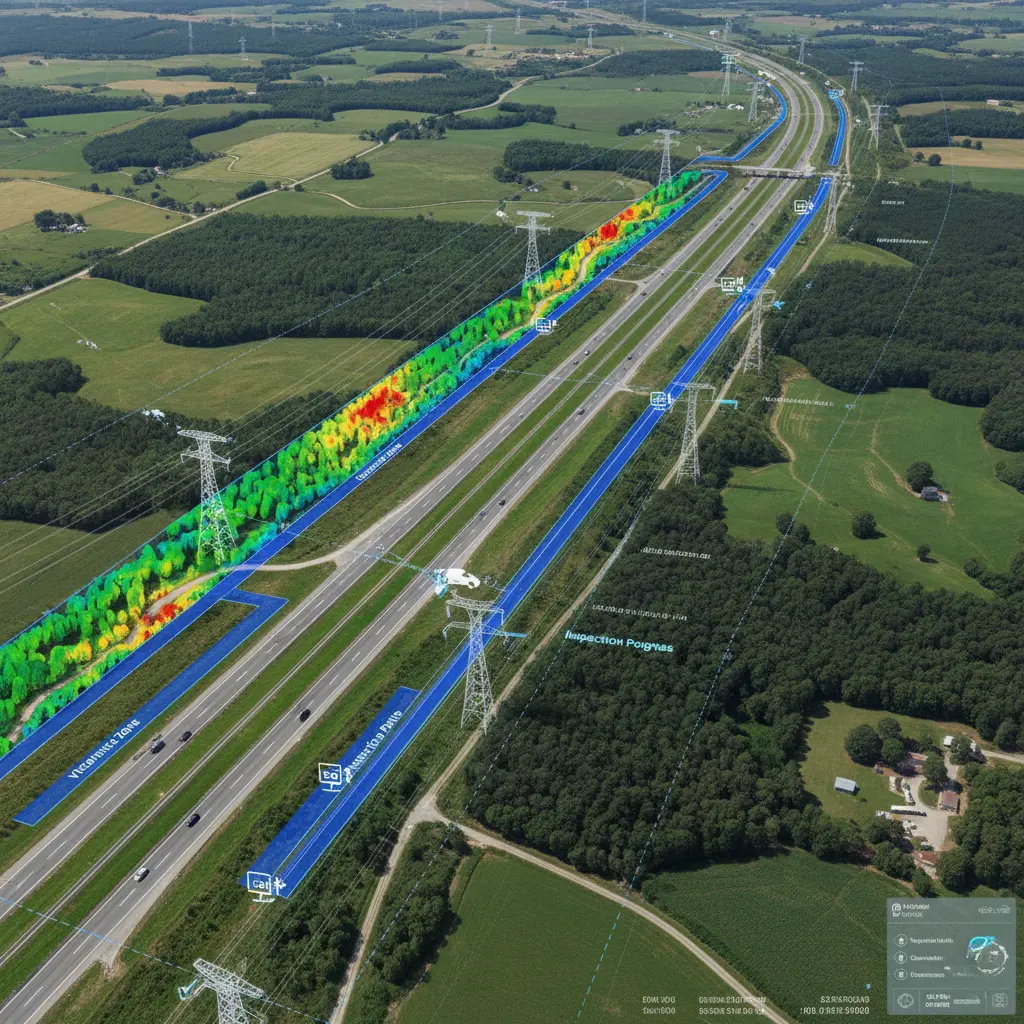
VegAlert Pro uses aerial imagery (drones, satellites) or vehicle-mounted cameras to continuously scan vegetation along roads and power line corridors. AI-driven image analysis identifies areas where trees or brush encroach beyond safe clearances and assesses plant health and fuel load. The system assigns risk scores to segments based on density and proximity of growth. Maintenance crews receive prioritized trimming alerts, enabling proactive vegetation control. By predicting future encroachment using growth models and weather data, it optimizes resource allocation to high-risk zones.
Challenges
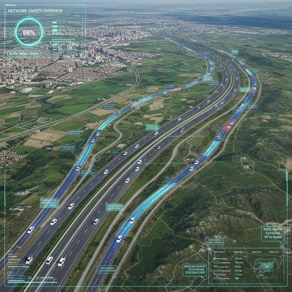
- Vast areas: Inspecting thousands of kilometers manually is slow and expensive.
- Rapid regrowth: Vegetation can grow quickly between fixed trim cycles, raising fire risk.
- Hidden hazards: Human inspectors may overlook issues in inaccessible spots.
Solution
- Automated scanning via drones/cameras covers large regions quickly, identifying only problem areas.
- Frequent AI-assisted scans detect sudden overgrowth, allowing flexible scheduling of maintenance.
- High-resolution imagery combined with AI can spot encroachment under power lines or at remote sites that inspectors might miss.
Key Features
How it works?
How is it used?
A highway maintenance agency uses VegAlert Pro before fire season. Drone imagery shows a section where fast-growing scrub has encroached on the roadside. The AI assigns it a high-risk rating and schedules a crew to clear the brush. Without this system, the overgrowth might have gone undetected until a hot summer day ignited a fire.
What impact does it deliver?
By focusing efforts on the worst hotspots, the solution can prevent a large fraction of vegetation-caused incidents. For instance, AI-driven risk models allow agencies to address the top 20% of risky segments first, covering the majority of exposure. This risk-based approach significantly reduces wildfire exposure compared to uniform trimming. Organizations report lower maintenance costs (up to ~30% savings) since they trim only where needed. Overall, VegAlert Pro helps maintain safety compliance and can dramatically cut the number of fires sparked by roadside vegetation.